GeoCity

“GeoCity” is an interactive experience that brings together multi-layered data about our world, and provides a playful way of encountering this information. At the same time, “GeoCity” also opens up a totally new way of looking at the City of Linz as a localized setting for everyday life.

80+1 – A Journey Around The World

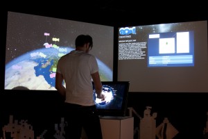
At this station visitors experience the state of the Planet via up-to-the-minute bulletins, statistical data, and visualizations of real-time global movements such as volcanic & seismic activity and air & ship traffic.

Linz and the World
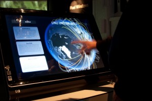

This station delivers an insight to the the economic, touristical and cultural exchange between Linz and the globe.

Pixel City


Every city is just as distinctive as each of its inhabitants, whose respective personalities, histories and cultures are unique, integral parts of the urban mosaic. “Pixel City” translates this into a spatial installation. Building blocks form cubic urban structures that grow up out of the floor of the exhibition space.

Pixel Windows


Mobile micro-projectors make virtual windows appear in the “Pixel City”. They let visitors to glimpse behind the walls, onto the streets and into the inner courtyards of “Pixel City” and discover the narratives they have to relate.

Procedural City
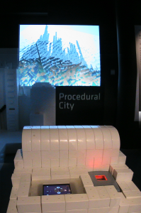

Every city is just as distinctive as each of its inhabitants. By using a fingerprint scanner visitors create the “ground plan” of a city. An algorithmic program then uses this as the blueprint for an urban structure comprised of building blocks similar to the plastic cubes used in “Pixel City”.

SimLinz
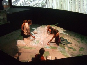

“SimLinz” is a futuristic prototype of an interactive urban- and geo-information system that – on the basis of Linz – provides interesting and unusual insights into the city and its functions. Exemplary data from the 1950s to the present let users follow Linz’s development over time. “SimLinz“ has been conceived as a walk-through database that utilizes new means of communication to get across complex, interrelated information in an intuitive way. Whether it’s a book or a city map – everything morphs into an interactive surface.